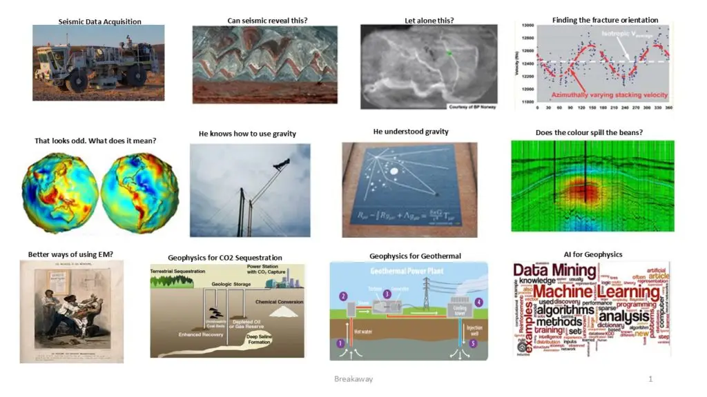
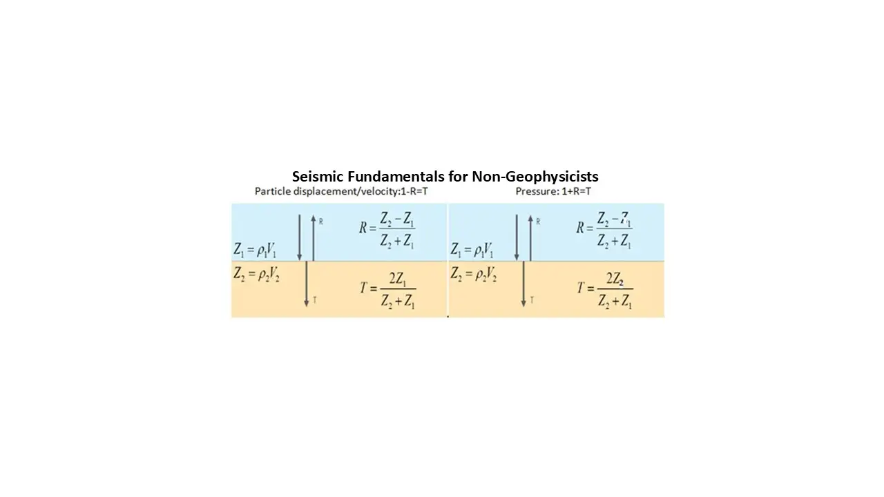
What geophysics is all about.
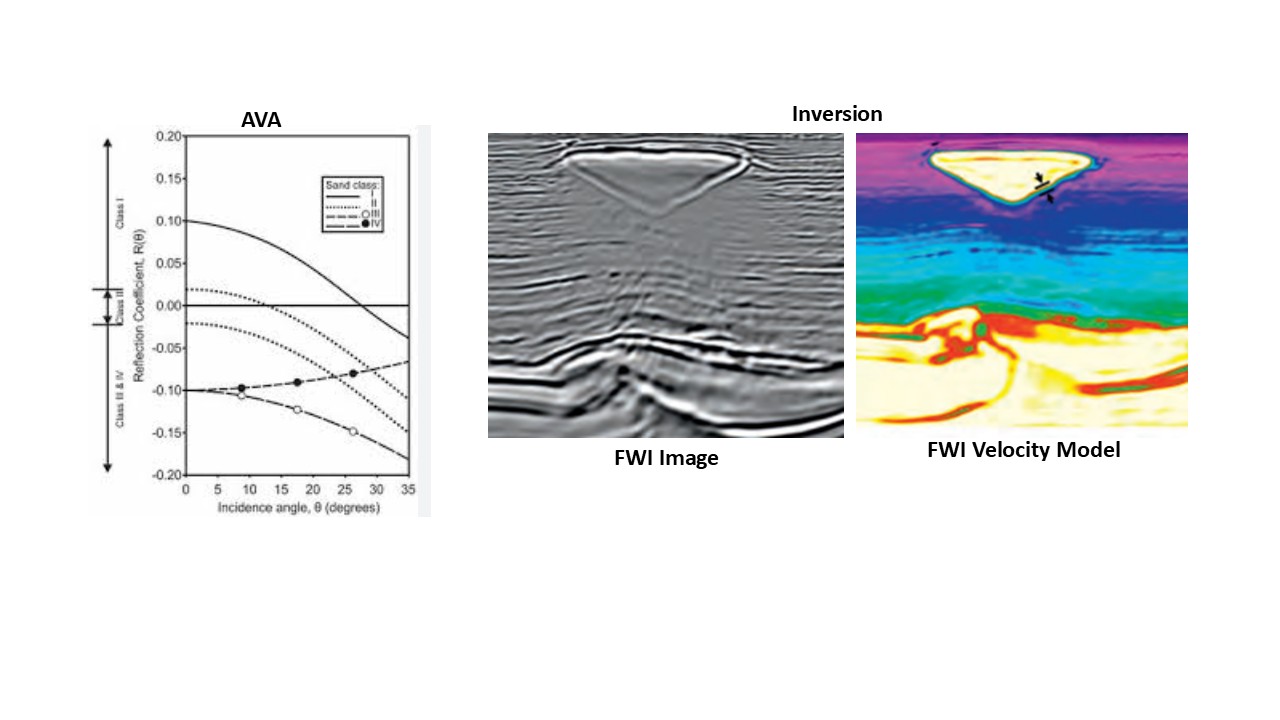
AVA + Inversion
Course Description
Program
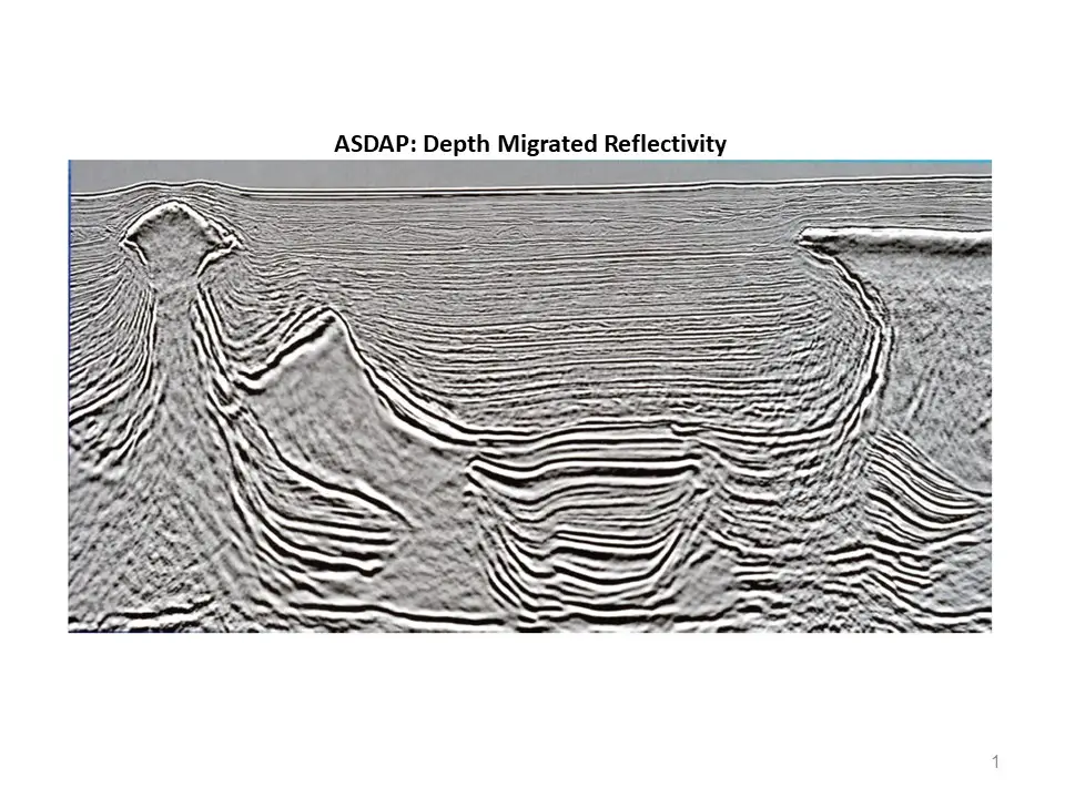
ASDAP
Course Description
Program
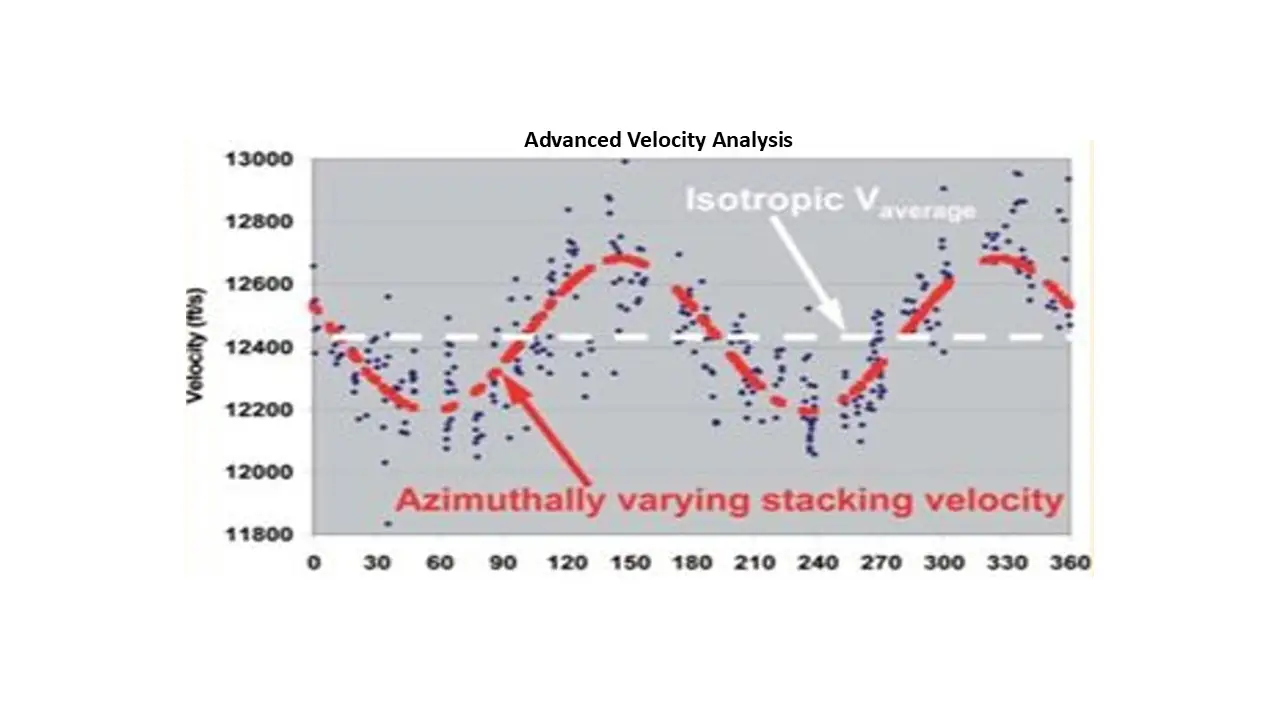
AVM
Course Description
Program
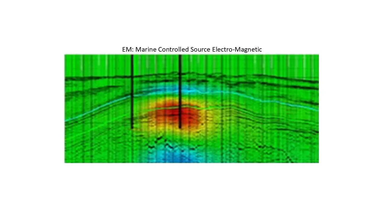
EM
Course Description
Program
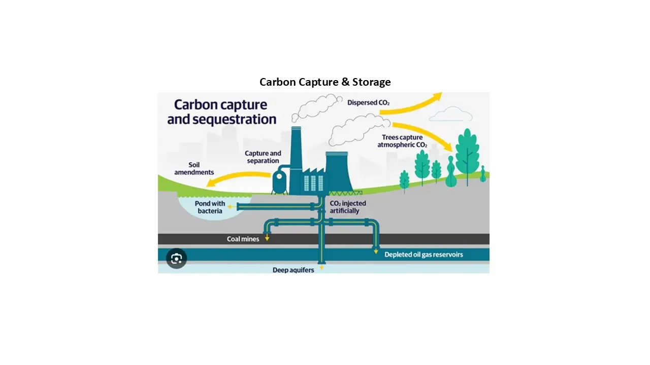
GCO2
Course Description
Program
GDAP
Course Description
Program
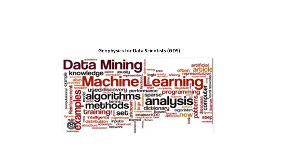
GDS
Course Description
Program
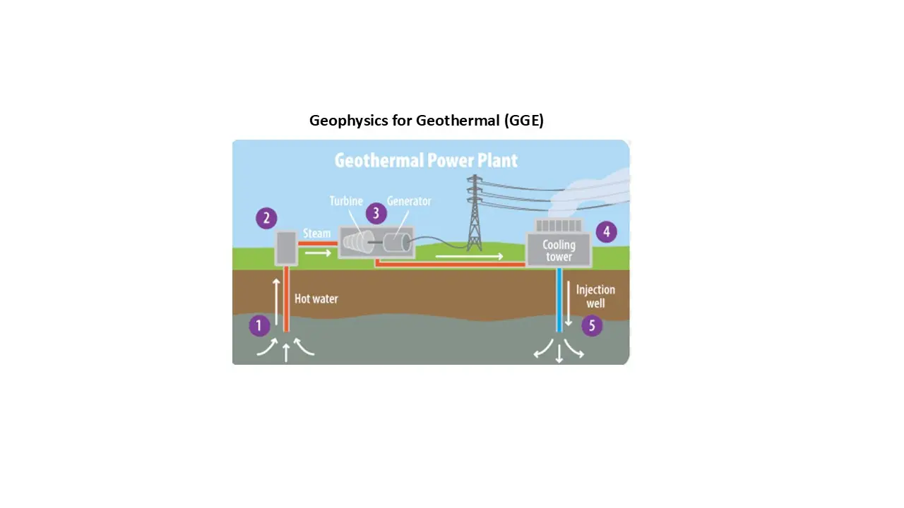
GGE
Course Description
Program
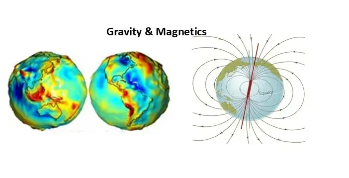
GravMag
Course Description
Program
QRC
Course Description
Program
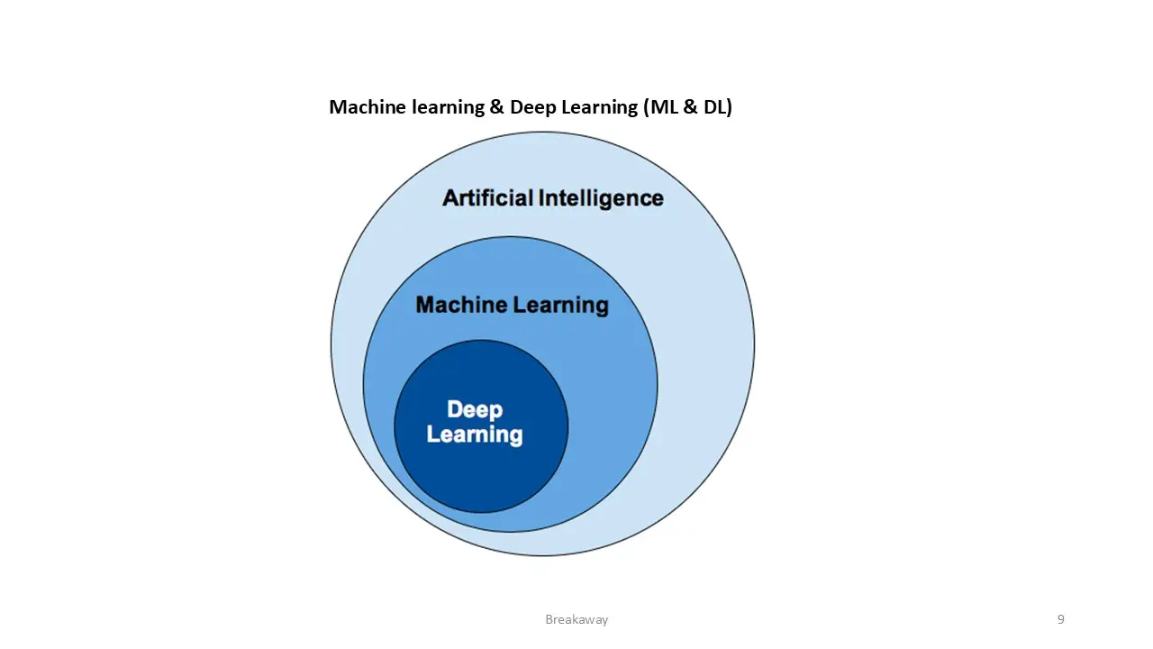
ML & DL
Course Description
Program
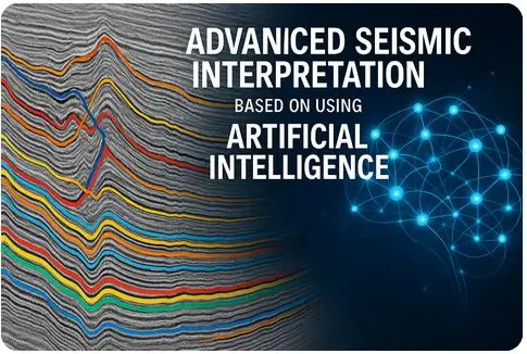
ASIAI
Course Description
Program
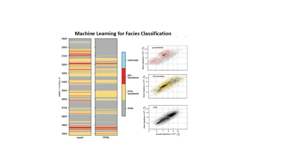
MLF
Course Description
Program
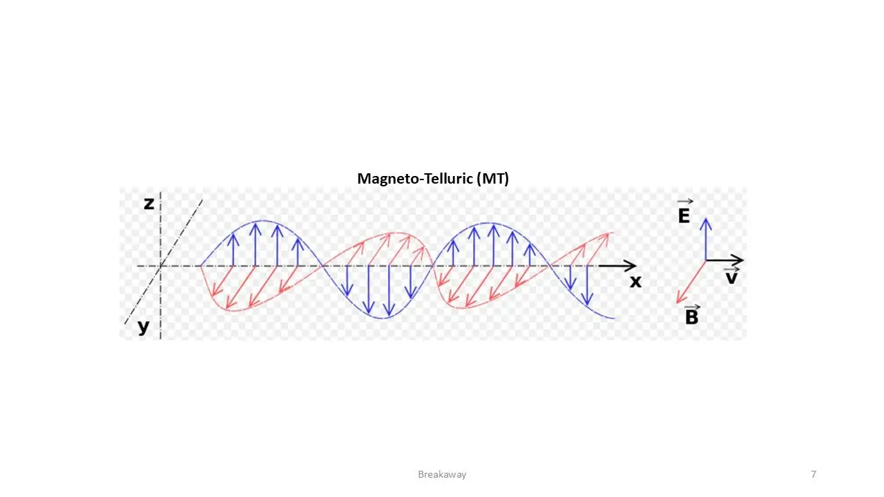
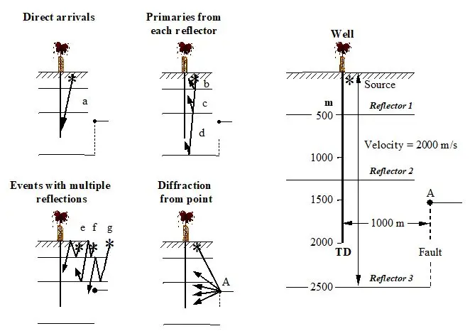
MT
Course Description
Program
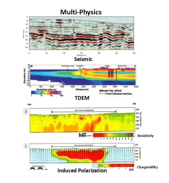
Multi-Physics
Course Description
Program
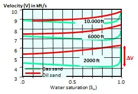
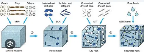
Rock-Physics + AVA
Course Description
Program
WSP
Course Description
Program
Go to the course you have applied for
Geophysical Curiosity Semi-supervised Learning
Course News: AVA Inversion
Video of the month: AVA Tutorial I
CV
Are you ready for AI in Geophysics